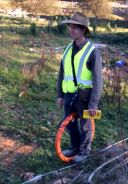
The EM34 is a great tool to detect water seepage, edges of landfill and any vertical contact or mineralisation. The is operated by two persons, one moving the Transmitter coil (Tx) and one moving the Receiver coil (Rx). The EM34 measures the bulk conductivity of the rock volume between the two coils and instantly and digitally displays the conductivity. The instrument is equipped with three reference cables connecting the two coils, 10m, 20m and 40m. The longer reference coil being used, the greater depth penetration.
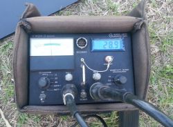
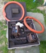
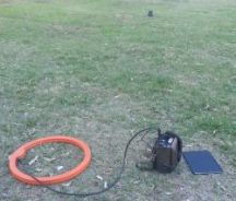
The results are available during survey without a requirement of lengthy or time delaying post-survey processing. The picture to the left is of the receiver display including the conductivity read-out (the top right digital display) and the second picture is the EM34 in its transportation box measuring 1m x 1m x 0.3m (coils are both ~65cm in diameter). The third picture displays the EM34 in survey mode with the Rx in the foreground and the Tx at the top of the image, and the fourth and last picture is during survey (in horizontal magnetic dipole configuration). Readings take about 5-10 seconds and the instrument will be carried by the two operators and is only briefly put down for a measurement (picture 4).
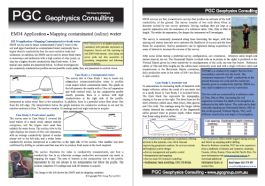
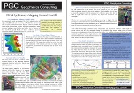
An informative two page flyers demonstrating the use of EM34 for detecting edges of landfill / soil conductivity is available for download below (check back in the near future as more are being compiled).
- Detection of edges of Landfill
One particularly useful application of the EM34 is the detection of edges of landfill in historic waste dumps. The detection is based on one of several common conditions: old waste will weather to clays and or various types of salts (among other waste products); less dense material will retain moisture leading to clayification; and higher level of moisure in the disturbed ground. Each of these conditions produces conductive material, whether the moist soil, salts or clay, and will be detected by the EM34. For more information, please download this informative flyer by clicking on the thumbnail image below.
- Mapping contaminated (saline) water underground
EM34 can be used to detect contaminated ("salty") water in the soil and upper basement as contaminated water commonly has a higher electric conductivity than the more resistive rocks and sediments. In addition, the EM34 can be used to detect fresh water in waterways and sediments with a high content of clay (mud), as clay has a higher electric conductivity than fresh water. For more information, please download this informative flyer by clicking on the thumbnail image below.